
Red Bulletins | August 11, 2025
Introduction
The 2025 Atlantic hurricane season is rapidly emerging as one of heightened peril—from record-warm waters to mounting storm forecasts. This year’s outlook carries significant implications for coastal communities from the Caribbean to Canada, demanding renewed vigilance. Below is a detailed, research-driven overview infused with original insights and deeper local context.
Detailed Event Coverage
- NOAA Forecasts Above-Normal Activity
The National Oceanic and Atmospheric Administration (NOAA) predicts an above-average season, expecting 13–19 named storms, 6–10 hurricanes, and 3–5 major hurricanes (Category 3+). There’s a 60% likelihood of an above-normal year, reflecting warmer seas, weak wind shear, and active West African monsoon patterns ChronCT Insider. - Colorado State University Aligns
Colorado State researchers echo NOAA’s outlook, forecasting 17 named storms, 9 hurricanes, and 4 major hurricanes Reuters. - Recent Storm Activity
Despite the robust forecasts, the season began quietly. By early August, only four storms have formed—Andrea, Barry, Chantal, and Dexter. The combined ACE (Accumulated Cyclone Energy) through August 8 stands at just 3.7, pointing to a slow start Wikipedia.
Latest Updates
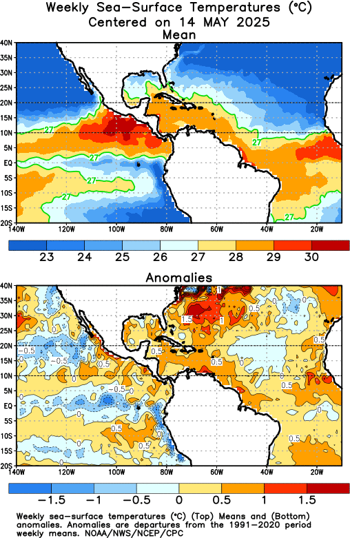
- Sea Surface Temperatures (SSTs) Surge
Gulf of Mexico and tropical Atlantic SSTs are 2–4 °F above average, with some shelf waters near Florida pushing 90 °F—fueling potential storm intensification Chron. - Season Peaks Amid Rising Activity
As the season enters its meteorological peak (late August through mid-September), activity is accelerating. Tropical Storm Dexter formed in early August but poses little threat, drifting northeast away from land CT InsiderPeople.comChron. - Forecasting Challenges Ahead
Federal budget cuts have halted the sail drone program—an important tool for measuring surface winds and ocean temperatures—potentially hindering storm intensity forecasting precision Beaumont Enterprise.
Expert Opinions
Meteorologist Chad Merrill of AccuWeather emphasizes that the combination of warm Atlantic waters, minimal Saharan dust, and favorable wind shear could support the rapid organization of storms such as the impending system named Erin AccuWeather.
NOAA officials note that four-day hurricane track forecasts today rival the accuracy of two-day forecasts from 2005, aided by an upgraded Hurricane Analysis and Forecast System improving precision by another 5% CT Insider.
Impact & Reactions
- U.S. Gulf Coast & Florida: Regions like Texas and the Gulf Coast face elevated threats this season, building on last year’s devastation from storms like Beryl Chron.
- Caribbean Islands: Northern zones like the Bahamas and Puerto Rico remain highly vulnerable, while southern islands like Trinidad and Barbados are comparatively safer, though still at risk The Times.
- Infrastructure & Emergency Response: Forecasting gaps due to lost sail drone data may weaken storm preparedness, particularly in real-time intensity tracking. Agencies must compensate with alternate tools or enhanced ground-based monitoring.
Unique Insight: The sluggish early season may lull regions into complacency; yet, late-developing storms, fueled by rising SSTs, could deliver greater intensity with shorter warning times—underlining the need for readiness despite early calm.
Conclusion
As the 2025 Atlantic hurricane season gains momentum, its trajectory points toward heightened urgency: warmer seas, aligned forecasts, and a window for sudden intensification demand that communities stay vigilant. Accurate, advanced warnings—especially in light of data challenges—become all the more critical.
Expect elevated risk this year. NOAA and Colorado State forecasts indicate increased storm frequency and intensity. Warmer waters near Florida (up to 90 °F) may amplify storm strength, underlining the importance of emergency readiness and monitoring vacation plans even in early season months. Chron+1
Yes—especially the northern Caribbean and Bahamas. Tourism-dependent economies should closely monitor forecasts and consider trip insurance that covers weather disruptions. Southern islands are historically less impacted, but vigilance remains wise. The Times
Forecast precision has significantly improved—four-day track predictions now rival two-day accuracy from 2005, thanks to upgraded forecasting systems. However, intensity forecasting may suffer due to reduced sail drone data. CT InsiderBeaumont Enterprise
While early activity has been low, seasonal forecasts consider long-term factors like SSTs and wind shear. Experts caution that even slow-starting seasons can rapidly escalate—so preparedness shouldn’t wane based on early quiet. Prognoses remain credible but not absolute.